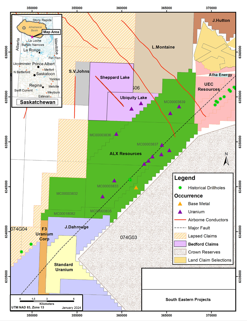
The Ubiquity Lake Uranium Project, spanning 1,382 hectares, is strategically located just south of the southern edge of the Athabasca Basin. To the east, it shares a boundary with ALX Uranium’s Carpenter Lake Project and lies adjacent to the prolific Cable Bay and Virgin River Shear Zones. These zones are known for their rich uranium deposits, including Cameco’s Centennial deposit located just 40 km northeast.
Moreover, the project is situated 100 km west of the historic Key Lake mine, which was a major producer, extracting 225 million pounds of uranium with a high ore grade of 2.3% U3O8 from 1983 to 1997. With its significant historical yields and geological prominence, the Ubiquity Lake area presents an exceptional opportunity for uranium exploration and potential development.


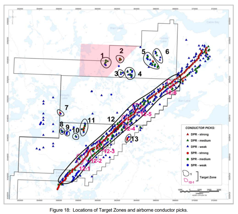
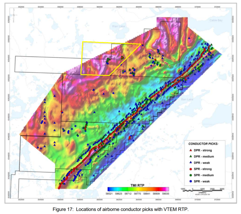
In 2007, a comprehensive GEOTEM survey of the Ubiquity Lake Project uncovered a significant southeast-trending conductor, slicing through the property for several kilometres. This discovery was pivotal, leading to further exploration in 2014 by Alpha Exploration. They conducted a VTEM survey and surface sampling, which confirmed the initial findings and revealed an electromagnetic feature perpendicular to the original EM anomaly and aligned with the Cable Bay Shear Zone.
Moreover, these investigations identified exceptionally high uranium values in outcrop and float samples, aligning with the areas highlighted by both Z-TEM and VTEM surveys. This comprehensive exploration has pinpointed two high-priority target zones within the property, setting the stage for focused exploration efforts.
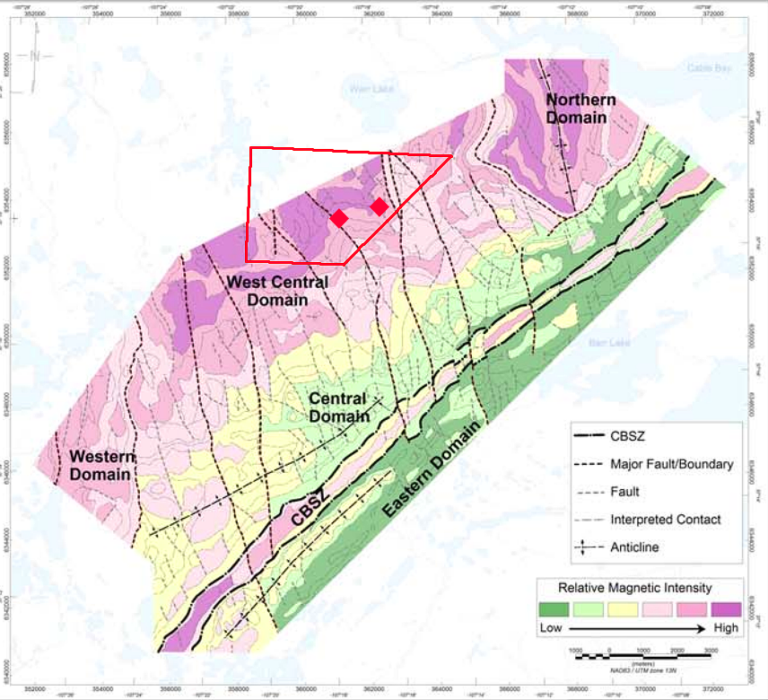
At TZ-1, a sample measuring 678 ppm U, 679 ppm Th, and 449 ppm Mo from a quartz-rich pegmatitic granitic gneiss boulder was identified. TZ-1 lies in the West Central magnetic domain and is characterized by weak to medium DPRs and SPRs. DPR profiles indicate it dips to the east along a 500-600 m strike length. The TZ sits within a magnetic high but a tilt angle low, indicating that it may follow some structure. The southern end of TZ-1 trends along an interpreted major NW-SE fault.
At TZ-2, a sample grading 187 ppm U, 449 ppm Th from pegmatitic quartz-rich zones was identified in a granite gneiss outcrop. TZ-2 consists of a cluster of Medium to Strong SPRs. Although it is on a magnetic and tilt angle high, TZ-2 trends along an interpreted fault and is adjacent to a major structural feature. TZ-2 is in the West Central magnetic domain.


Address: 2200 – 885 West Georgia Street, Vancouver, B.C. V6C 3E8 Canada
Copyright © Bedford Metals Corp. 2024 All Rights Reserved.